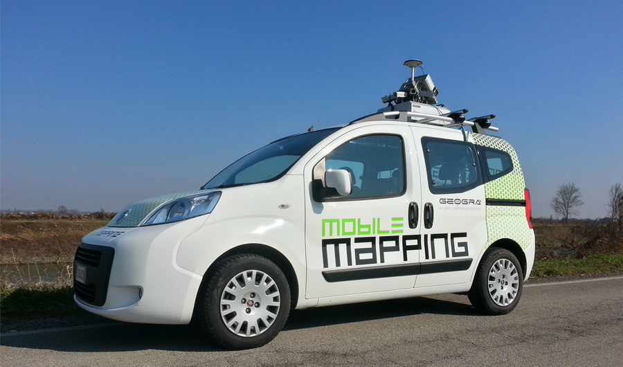
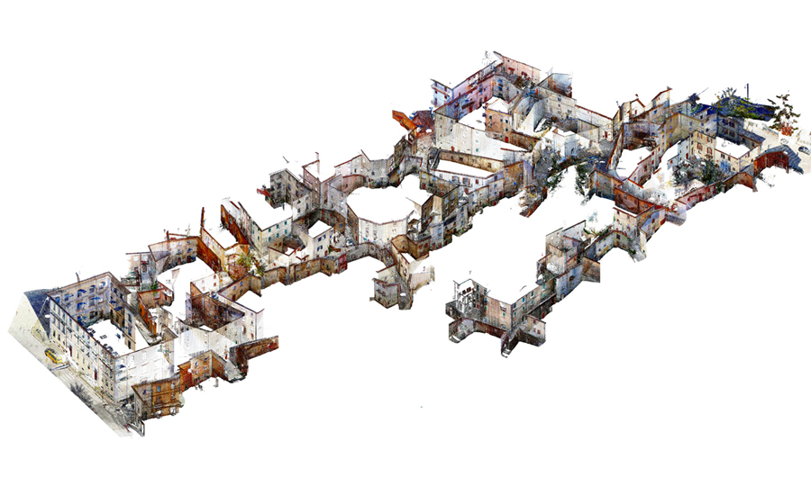
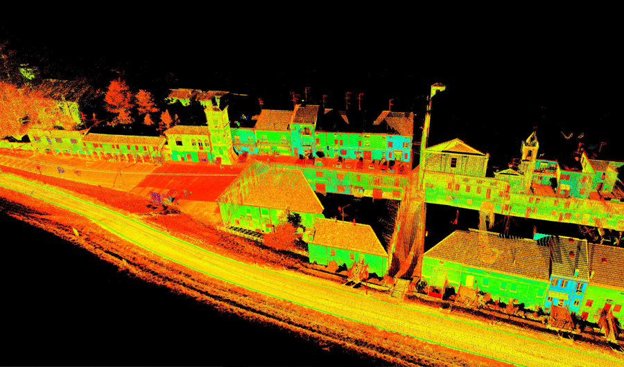
The mobile system designed for dynamic terrestrial survey allows to measure all visible elements while in
motion; this enables to obtain a large amount of information: sections, contours, sizes, volumes, everything
which is at the base of 3D modeling (BIM).
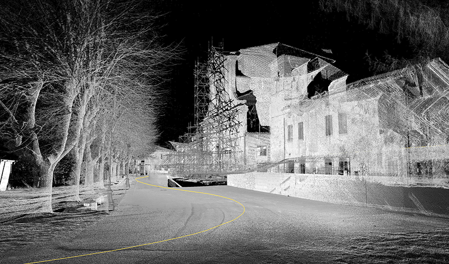
It was created to measure large areas in a short time: at 35km/h it is possible to survey a range of 100
metres on the right and on the left of the scanner with a very high density of points (a point every 7 mm).
3D data are integrated with the 360-degree view of 6 photogrammetric cameras; captured images are used
to colour the 3D data.
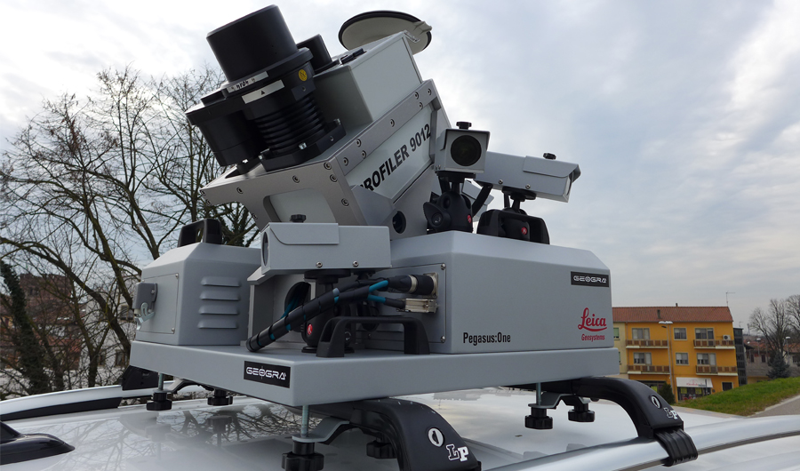
The mobile system integrates multiple technologies: laser scanner or profilometer (from 50hz to 200hz),
Inertial Measurement Unit (IMU), GPS antenna, photogrammetric cameras, digital odometer all managed
by software.
The IMU is composed of accelerometers and gyroscopes used to measure angular velocity and acceleration
necessary for the calculation of movements (position, speed, acceleration, direction and rotation).
These measurements allow to calculate the trajectory with extreme precision.
The points are projected onto space using GPS data and oriented by inertial system.
The points cloud obtained is georeferenced using WGS84 coordinates.